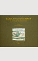

Vie e luoghi dell’Etruria nella tavola Peutingeriana
2003, cm 30 x 35,5, ii-68 pp. con 22 figg. n.t. e 1 pieghevole a colori di cm 160 x 29. Rilegato in seta.
ISBN: 9788822252746
- About this book
- Author
- Extra (1)
- E-book
Tabula Peutingeriana. Le antiche vie del mondo:
The reproduction of the world’s oldest street map in existence: drawn by the Romans sometime in the 4th century, it marked out the vast territory of the Empire, as well as keeping track on military expansion. In the 16th century it was reproduced on an approximately 7 metre long parchment roll, the source of this publication, that is today conserved in Vienna’s National Library.
This is an enlarged colour reproduction of the facsimile of the Tabula Peutingeriana published in 1916 by K. Miller.
Francesco Prontera
Francesco Prontera, ordinario di Storia greca all’Università di Perugia, ha fondato nel 1992 la rivista internazionale «Geographia Antiqua» (Firenze, Leo S. Olschki), che tuttora dirige. I suoi studi riguardano prevalentemente le rappresentazioni dello spazio geografico nella letteratura greca (Erodoto, Polibio, Strabone) e nella cartografia antica (Eratostene, Tolemeo, la Tabula Peutingeriana) esaminate nel loro contesto storico. Una raccolta in castigliano di alcuni contributi è uscita nel 2003 (Otra forma de mirar el espacio: geografía e historia en la Grecia antigua, Málaga, CEDMA). - (novembre 2011) -
Buy the ebook from an our partner's store